Curiosity Blog, Sols 4589 – 4592: Setting up to explore Volcán Peña Blanca

Written by Abigail Fraeman, Deputy Project Scientist at NASA’s Jet Propulsion Laboratory
Earth planning date: Thursday, July 3, 2025
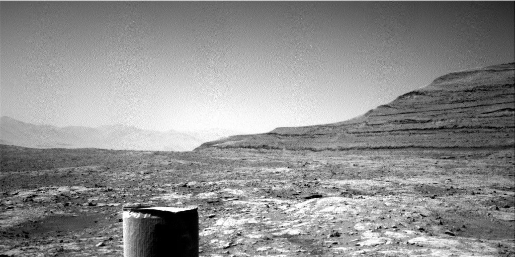
The team was delighted this morning to learn that Wednesday’s drive had completed flawlessly, placing us in a stable position facing a ~3 foot high ridge located ~35 feet away. This ridge is the eastern edge of a feature the team has informally named “Volcán Peña Blanca.” This feature certainly looked intriguing in orbital images, but once we saw Curiosity’s pictures of it from the ground, we decided it was cool enough to spend the time to investigate it closer. The images from the ground show a lot more detail than is visible in orbit, including clear sedimentary structures exposed along the ridge face which could provide important clues about how the rocks in the boxwork-bearing terrain were initially deposited – dunes? Rivers? Lakes? The team picked their favorite spot to approach the ridge and take a closer look during Wednesday’s planning, so Curiosity made a sharp right turn to take us in that direction. Using today’s images, we refined our plan for the exact location to approach and planned a drive to take us there, setting us up for contact science on Monday.
We had the opportunity to plan four sols today, to cover the U.S. 4th of July holiday weekend, so there was lots of time for activities besides the drive. Curiosity is currently sitting right in front of some light toned rocks, including one we gave the evocative name “Huellas de Dinosaurios.” It’s extremely unlikely we’ll see dinosaur footprints in the rock, but we will get the chance to investigate it with APXS, MAHLI, and ChemCam. We also have a pair of ChemCam only targets on a more typical bedrock target named “Amboro” and some pebbles named “Tunari.” Mastcam will take a high resolution of mosaic covering Volcán Peña Blanca, some nearby rocks named “Laguna Verde,” a small light colored rock named “Suruto,” and various patterns in the ground. Two ChemCam RMI mosaics of features in the distant Mishe Mokwa face and environment monitoring activities round out the plan.
Explore More


 July 08, 2025 at 04:51AM from NASA https://ift.tt/AZhmv4s

Comments
Post a Comment